Walking
28 March 2025
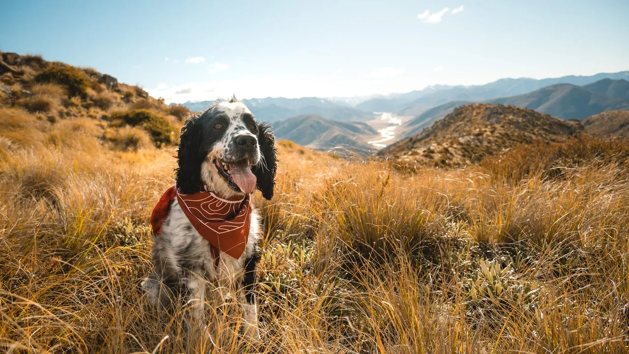
Dog friendly walks in Canterbury
Grab your floofy bestie and head on an adventure.
Hit the trails around Canterbury with your doggo on your tail
Make your pooch the happiest on these dog friendly walks across Canterbury. From easy short walks to full-day hikes, every good dog loves an adventure. Thanks to our friend Jay French for helping us put this piece together. Check out more of his work on his website.
Mt Isobel (North Canterbury)
Said to be “Canterbury’s most climbed mountain,” this one can be ticked off on a day trip from Christchurch, or as part of an overnight stay in Hanmer Springs. After conquering the walk, reward yourself with dinner and drinks in the Hanmer Springs township and an evening soak in the pools.
Mt Isobel has four routes with different lengths and difficulties. If you're up for a challenge, you can link up the tracks for a mega loop. The tracks are well-marked but be sure to plan your walk well if you're taking one of the longer tracks.
Features:
- Great views over Hanmer Springs, and on the waterfall track (a 41 metre-high waterfall)
- Time: Approximately 5.5 hours return
- Dogs: Under effective control
- Caution: Some steep areas with loose ground and slips


Mt Dumblane (North Canterbury)
A great alternative to the close-by Mt Isobel, Mt Dumblane offers the same great views over Hanmer Springs and the surrounding area. Built by the Mt Isobel tramping group, this easy-to-follow track is new but wearing in well. The route starts in Jacks Pass, and once upon the main ridge, you'll be rewarded with stretching views up the Clarence River and towards the Lewis Pass.
While this is an easy hike, moderate fitness is required. Given that this is in sub-alpine terrain, this track may be closed in winter due to snow.
Features:
- Big views and relatively easy hiking
- Time: Approximately 4-5 hours return
- Dogs: Under effective control
- Caution: Track can be slippery in the winter, and some steep areas
Lake Emma (South Canterbury)
This relatively flat and easy walking trail starts at Lake Camp then skirts around the base of Mt Harper and ends at the Lake Emma hut. The lake is picturesquely framed by the surrounding mountains, throwing delightful reflections across Lake Emma. There's a good chance you'll see no other soul on the track, so you and your furry bestie can relax uninterrupted in this beautiful landscape before trekking back home. If walking in winter or after rain, you may get wet on the river crossing so be mindful about what gear you'll need.
Features:
- Easy trails with close proximity to the Lake Clearwater township
- Time: Approximately 5 hours return
- Dogs: Under effective control
- Caution: Dogs not welcome near the shores of Lake Camp or Lake Clearwater


Pinchgut Hut (North Canterbury)
This delightful walk winds through various valleys following the Onuku River before ending at a great camp spot and Pinchgut Hut at the base of Mt Thomas. The trail is mainly undulating with a sharper climb partway through. There are plenty of swimming opportunities along the track so on those hot days, you can dip your toes while your furry friend can cool off.
Once at the hut, there are plenty of trails that branch off. You can easily turn this moderate walk into a longer loop or a multi-day adventure if you're up for it. The trail is easy to moderate, with a couple of tricky features to navigate.
Features:
- A great hut and plenty of potential swimming spots
- Time: Approximately 5 hours return
- Dogs: Under effective control
- Caution: There’s a river crossing at the start, which could be quite high after rain or in the wetter months. High chance of wet shoes
Mt Vernon (Christchurch)
The closest walking track to Christchurch City, Mt Vernon offers a multitude of routes to the summit, from the valley floor to the sides flanking it. From the Huntsbury Reserve Track, take the first right onto the Connector Track, until you reach the Gorge Track. The trail here becomes green and lush, and you’ll forget how close to civilisation you are.
Climb your way up to the Dry Bush Track and once you reach the shelter, you can choose to continue up the valley or join up to the Farm Track. The Farm Track leads to the Lamar car park at the top, from here, cross the Summit Road and find the highest point for that epic panoramic view of the city.
Features:
- Views back over Christchurch city whilst only being 8min from the city centre
- Time: Approximately 3 hours return
- Dogs: On-leash only
- Caution: Remember to check your dog’s paws for grass seeds


Rabbit Hill (Mid Canterbury)
This walk has a little bit of wild in it. Summiting Rabbit Hill requires you to make your own route once you've reached 'Trig M'. To start, choose from one of two access points. Starting from Starvation Gully from the Lake Lyndon side is slightly shorter than the Coach Stream option on the Springfield side. The walk itself is not too hard or steep, mainly shingle and farm track as far as ‘Trig M,’ and then you pass through a tussock basin just before the final ascent to the summit of Rabbit Hill. There are a few pinchy climbs, but nothing too strenuous, with fantastic views over the surrounding mountains, lakes and back over the plains.
Features:
- The ‘Trig M’ peak is actually higher at 1251m than Rabbit Hill at 1198m
- Time: Approximately 4.5 hours return
- Dogs: Under effective control
- Caution: There is a muddy bog in the saddle just before you head to the summit of Rabbit Hill, your dog will probably love this, so you might want to bring a towel for after
Mt Richardson (North Canterbury)
Mt Richardson is another beautiful area in the Canterbury foothills with a few tracks that create a loop to the top. From the Glentui picnic area, head up the Richardson Track straight to the summit, or take the Bypass Track, connect to the Blowhard Track and up to the summit. The Richardson Track is relatively easy and good for people with moderate fitness. The Bypass Track is steeper with roots, mud and rock. Taking this route is an adventure, but you'll need to stay focused on tricky sections.
Features:
- A fantastic picnic area at the start and a nice waterfall to visit early on
- Time: Approximately 4-6 hours return for the whole loop
- Dogs: On-leash only
- Caution: It can get pretty dark in there, so take some lights if you think you might go into the evening


Foggy Peak (Mid Canterbury)
For a decent challenge, Foggy Peak will have you panting on its climb to the summit. The track doesn't start softly, with a sharp incline from the start. The trail is not well-marked in places; just look for cairns and markers to find your way up. It offers proper hiking from the beginning. Due to the incline, coming down can be quite hard on the legs, so use poles if you have them. There is a great plateau part way up with fantastic views back over the plains.
Features:
- Stunning mountain vistas and a great view of Lake Lyndon from above
- Time: Approximately 3 hours return
- Dogs: Under effective control
- Caution: In poor conditions, traction can be a problem and keeping to the less obvious trail
Mt Cloudsley (Mid Canterbury)
This great day hike leaves right from Castle Hill village, but be warned, this one can be challenging! Much of this track is on scree and is dotted with false peaks, so having poles would be an advantage. Once you get out of the trees, climb up the Long Spur Track to the summit of Mt Cloudsley, the second-highest peak in the Craigieburn Range. From here you'll be treated to views back over the valley, over Castle Hill and Broken River.
Features:
- Close to Porters Lodge if looking for somewhere to grab a bite after
- Time: Approximately 3 hours return
- Dogs: Under effective control
- Caution: In poor conditions, traction can be a problem and keeping to the less obvious trail


Mystery Lake (Mid Canterbury)
The Mystery Lake hike winds its way alongside the Potts River, gradually inclining to reveal views of the snowcapped mountains and the Rangitata River. The start of the track is quite narrow, before opening out onto a farm track walking through open tussock lands in the Hakatere Conservation Park. Once you reach Mystery Lake, take some time to explore this fascinating area. Climb over features like the roche moutonnées (rocky ‘knobs’ smoothed by passing glaciers), jumbled scree and check out the large Hall’s tōtara. This hike can be longer by linking up trails, including part of the Te Araroa Trail.
Features:
- A lake which completely freezes over in winter
- Time: Approximately 6.5 hours return
- Dogs: Under effective control
- Caution: In winter or snowy conditions, it can get quite icy underfoot, so prepare accordingly
Don't miss a thing
Sign up to our newsletter to get valuable updates and news straight to your inbox.
:quality(80))
)
)
Share