Walking tracks
Explore the walks in Selwyn
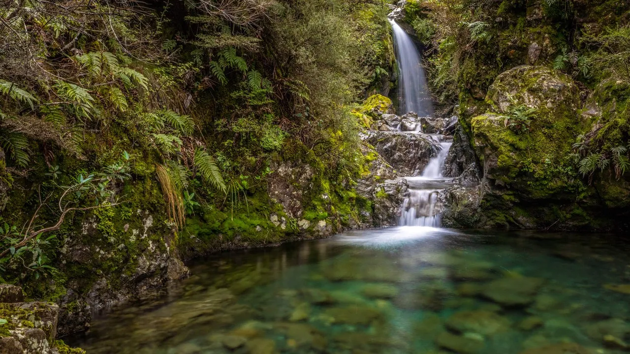
Explore diverse alpine vegetation, waterfalls, and stunning alpine vistas with a great range of walks in Selwyn.
Walking
23 May 2025
Explore the range of walks in and around the Selwyn district.
Walking tracks
Explore diverse alpine vegetation, waterfalls, and stunning alpine vistas with a great range of walks in Selwyn.

If you're driving to Arthur's Pass, be sure to check out these walks on the way.
Enjoy panoramic views of Kura Tāwhiti/Castle Hill and the Torlesse Range from this track.
Time to complete
Starting point
Magnificent scenic views. Interesting botanical specimens including celmisia, gentians and edelweiss.
Time to complete
Starting point
The grand limestone rock battlements of Kura Tawhiti led early European travellers to name this unique area Castle Hill. The area is rich in Maori history.
What you need to know
Time to complete
Starting point
A must do walk through limestone water-grooved rocks in an underground cave. Enjoy stunning views of surrounding mountains. The limestone formations nearby were used in the filming of The Chronicles of Narnia: The Lion, the Witch and the Wardrobe.
*Please ensure you have checked the weather conditions and have all the correct safety equipment before entering the cave. Also note there is a long term alert of the water depth increasing in this cave.
Time to complete
Starting point
Walk through mountain beech forest and alpine tussocks. The return trip can be made via the ski field road.
Time to complete
Starting point
A popular picnic site. View native tussock, small herbs and ground cover plants on the track. Cross over Broken River via a pole bridge.
Time to complete
1.5 hours return
The track climbs from the Lyndon Saddle along a steep ridge with open screes between beech forest. Enjoy spectacular views of the Craigieburn and Torlesse ranges and limestone formations.
Time to complete
Starting point
Walk the track from either end, through beech forest and across the Hogs Back Creek.
Time to complete
Starting point
Walk through an area that was used for trial planting from 1956 - mid 1970's.
Time to complete
Starting point
Cross Cave Stream and grassy terraces. View regenerating beech forest and low glacial terraces.
Time to complete
Starting point
A popular family walk. This is also a mountain biking track.
Time to complete
Starting point
Explore diverse alpine vegetation, waterfalls, and stunning alpine vistas with a great range of walks in Arthur's Pass.
Leisurely walk around historic sites in Arthur's Pass Village.
Time to complete
Starting point
Highlighting the best of Arthur’s Pass. Enjoy a view of the Dobson Memorial at Arthur’s Pass summit.
Time to complete
Starting point
Stunning red-flowering mistletoe/Pirirangi during summer. Expansive views of Waimakariri River valley and surrounding mountains.
Time to complete
Starting point
The most popular walk in Arthur’s Pass. Spectacular views of the waterfall.
Time to complete
Starting point
A signpost just north of Arthur's Chalet points to the carpark where the walk starts. Return the same way.
A great walk suitable for prams. Enjoy views of Avalanche Creek Waterfall.
Time to complete
Starting point
Passes an old pipeline that fed an electricity generator for rail tunnel construction.
Time to complete
Starting point
Good views of Arthur's Pass Village at end of track.
Time to complete
3-4 hours return to bushline. This track is for advanced trampers.
Starting point
Devils Punchbowl car park.
Pleasant forest walk, suitable for all-terrain baby buggies.
Time to complete
Starting point
View of summer alpine flowers. Climbs over an old glacial moraine and subalpine scrub and tussock.
Time to complete
Key highlights


Lake Coleridge was built around New Zealand's first state-owned hydroelectric power station, which was constructed between 1911 and 1914. Discover the history of the area with a great range of tracks from easy walks to longer day hikes.
Visit a place which is reputed to be a moa cooking site (discovered in 1960). Spectacular views stretching up the valley to the head of the Rakaia River with a stunning display of colour in autumn.
Time to complete
Starting point
Walk through a canyon formed by an ancient volcano. See waterfalls and views across the Canterbury Plains. Enjoy a track full of native bush and bird song.
What you need to know
Time to complete
Starting point
See spectacular geological areas, showing lava flows of rhyolite, pitchstone and andesite. View the Snowdon coal mines and enjoy the view of the bright blue crystal clear water of the Rakaia River.
Time to complete
Starting point
See native ferns, black beech, matai, white pine and bird life. Walk alongside the Rockwood stream.
Time to complete
Starting point
The Te Araroa Trail is a national walkway covering the length of New Zealand, with a portion of it going through the Lake Coleridge area in 3 sections. Walk alongside wetlands, farms, pine forest and the lake.
Time to complete
Starting point
Discover a broad range of native bird and wildlife and historical landmarks on these easy walking tracks. Highlights include Coopers Lagoon, Te Waihora/Lake Ellesmere and Birdlings Flat.
Walk through a wetland reserve and wild coastline. Expect to see abundant birdlife and classic wetland flora.
Starting point
Walk through native bush and view wooded swamp, Te Waihora/Lake Ellesmere and see native flaxes in flower during summer. The walkway ends at the Bird Hide.
Time to complete
Starting point
See historical landmarks around the township of Lincoln.
Time to complete
Starting point
See the changing landscape with one thousand years of human history. Pass by rural areas and townships with scenery including lakes, ancient volcanoes, rivers and natural vegetation.
Time to complete
Starting point

Don't miss a thing
Sign up to our newsletter to get valuable updates and news straight to your inbox.
:quality(80))
:quality(80))
)
Share